


1995
Army Corps of Engineers
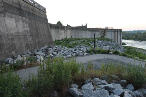
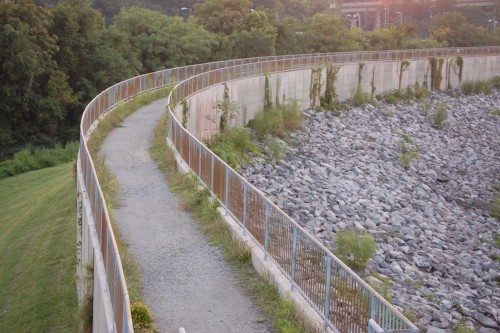
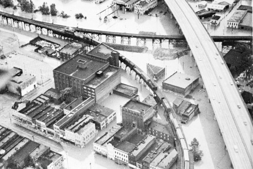
Following a string of floods during the 1970’s and 80’s, headlined by the city’s worst modern era flood of 36.5 feet in 1972, Richmond took preventative action in the form of a 3.2 mile floodwall system. This article focuses on a portion of that undertaking, the concrete wall in Manchester, which was built to withstand a water level up to 32 feet.
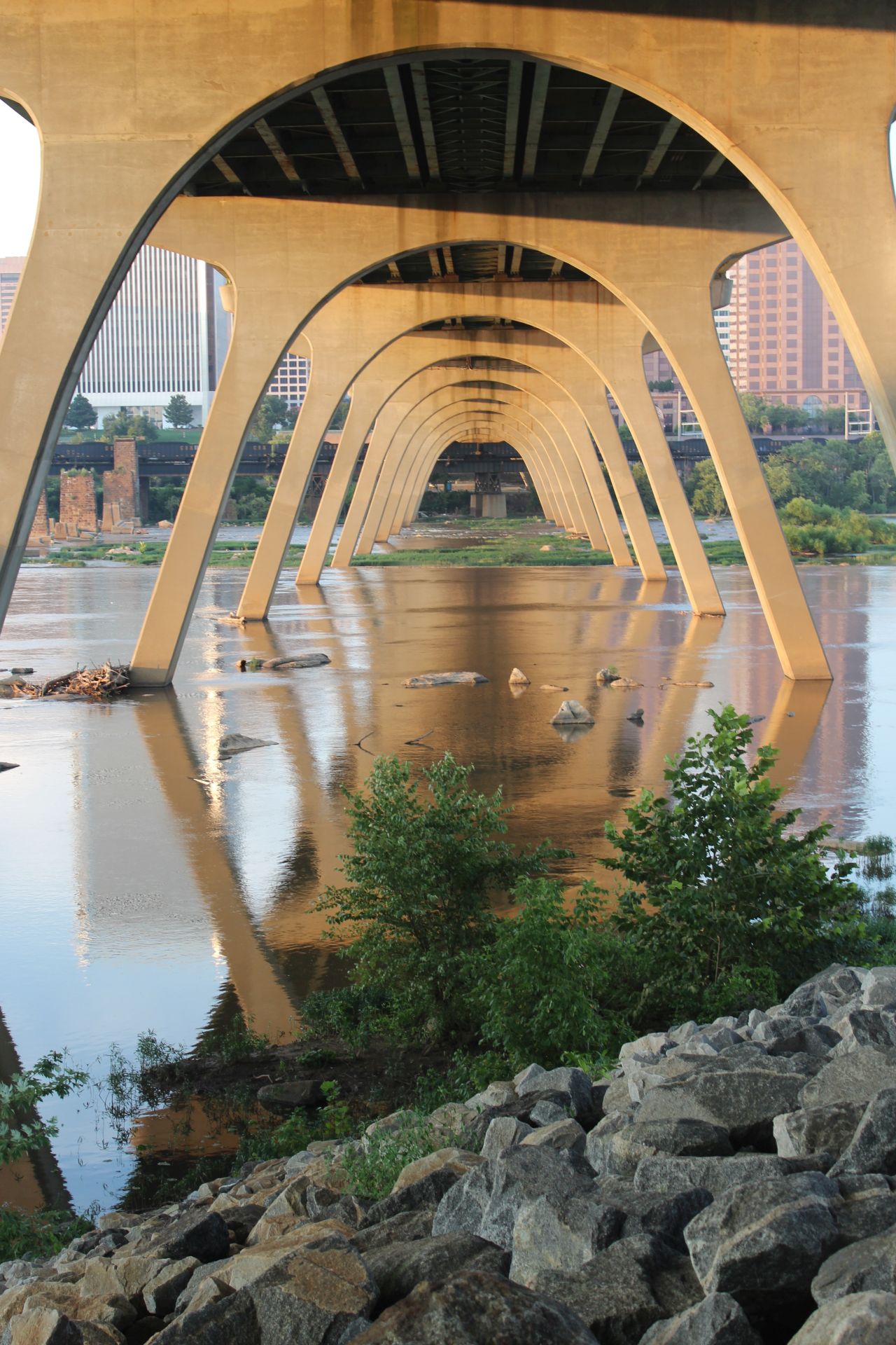
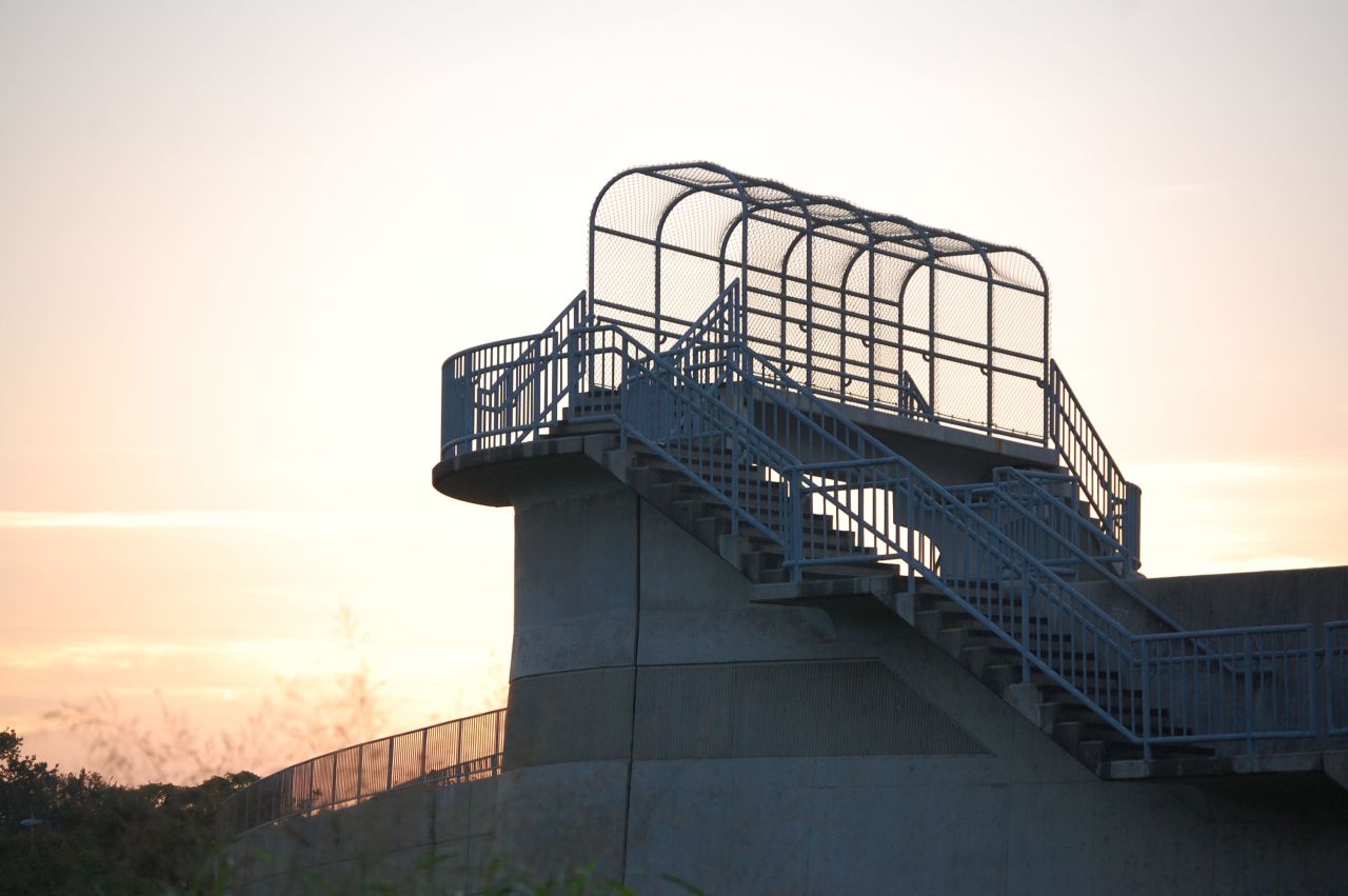
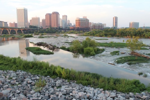
Due to its narrow dimensions and limited space for gathering, the Floodwall Walk is almost always experienced as a journey. If one starts the walk from the west, access is secluded at best with entrances the rear of the Suntrust building’s parking lot or in a nondescript lot off of Semmes Avenue. However the walkway quickly leads to the Manchester Overlook, featuring one of the city’s more flattering angles: a legible density of downtown with picturesque rapids beneath. The trail is continued steeply through a dense overgrowth down to the Manchester Climbing Walls, remnant monoliths of the Richmond and Petersburg railroad bridge which stood during the nineteenth century. A worn dirt path brings one underneath the massive arched supports of the Manchester Bridge, one of the most awe-inspiring spaces in the city. The heart of the Walk begins atop the concrete floodwall, which curves sharply to bends in the river. Riprap lines its northern face, a granite continuation of the herons’ rocky habitat in the river below. Both draw the attention of birders, fishermen and kayakers in the warmer months. The path rises above the CSX Viaduct and dips down to ground level behind the floodwall, meandering along a canal until a final lookout point at the 14th Street Bridge in the shadow of the Southern States building.
Approaching the 20th anniversary of the floodwall, it is difficult to imagine the river encroaching on the structure as it would have decades ago. Instead of a multi-million dollar barrier, what we see now is a path, a view, a park. While the structure doesn’t allow for the same level of pedestrian access to the river’s edge and the associated wading or sunbathing, it has become an amenity unique for a piece of civil engineering inherently intended to divide. And in contrast to the Canal Walk, its manicured counterpart along the northern banks of the James, the Manchester Floodwall Walk resembles a wilder kind of beauty, grown from layers of imposing infrastructure, untamed vegetation, minimal human intrusion and the incomparable James.
M.F.A.
Photographs by author and D.OK.
1 Comment
The railroad that passes thru the floodwall is Norfolk Southern, not CSX.
Write a Comment